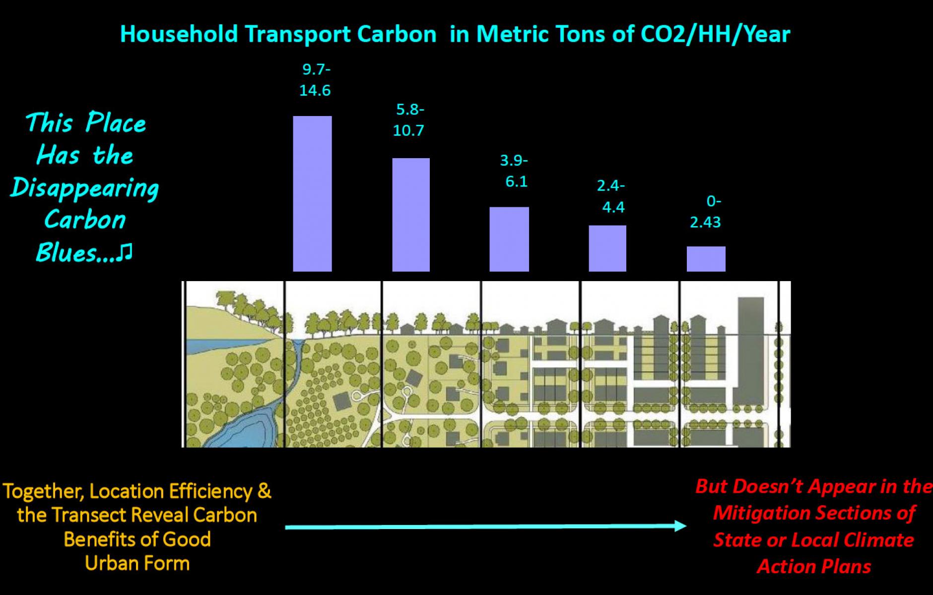
Transportation is a major source of household carbon emissions, and these emissions are reduced dramatically as Transect zones become more urban, as shown in this slide, presented by Scott Bernstein at CNU 30 in Oklahoma City in late March. I have seen similar correlations of traditional cities versus sprawling nations, but this slide relates to the scale of places that can be designed using the new urbanist idea of the Transect. It is remarkable in its clarity.
As settlement patterns become more compact, carbon emissions decline, largely because of “location efficiency” and transportation choices. The biggest drop is from Sub-Urban, which the third T-zone from the left, to General Urban, the third from right. General Urban neighborhoods are mostly residential, often with a mixture of “missing middle” and single-family residential types. General Urban should be walkable to a neighborhood center or Main Street area, represented by the next T-zone over. Dense downtowns are farthest to the right. The six-zone rural-to-urban Transect drawing was created by DPZ CoDESIGN.

